Hobart Storm Water District is launching a comprehensive, phased, multi-year initiative to better understand, maintain, and improve its stormwater infrastructure. This effort will begin with contracted personnel making a detailed inventory and condition assessment of the City’s stormwater assets. Using modern GIS tools and video inspection, the project will map and rate the condition of pipes, inlets, and other system components. The data collected will help create standardized maintenance schedules, identify areas where improved maintenance could benefit water quality, and guide the development of standard operating procedures.
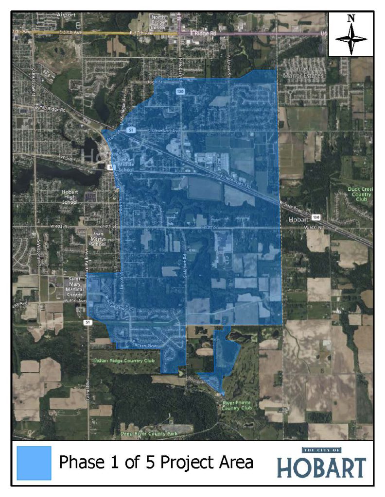
The first phase of data collection will begin in May 2025 and focus on an area roughly bounded by Lincoln Street to the west, Bracken Parkway to the south, County Line Road to the east, and Cleveland Avenue to the north. Additional locations with known drainage issues will also be included. Future phases of this project will continue through 2029, gradually expanding coverage across the city.
Looking ahead, the project will help District plan for the future by modeling the existing stormwater system under current and future development conditions. This modeling will identify problem areas, evaluate alternatives, and support the creation of a prioritized Capital Improvement Plan with estimated costs. The project will also include a financial review, assistance with grant opportunities, and support for the District’s stormwater regulatory requirements. A key part of this work will be engaging the public—both to gather information and to keep the community informed throughout the process.